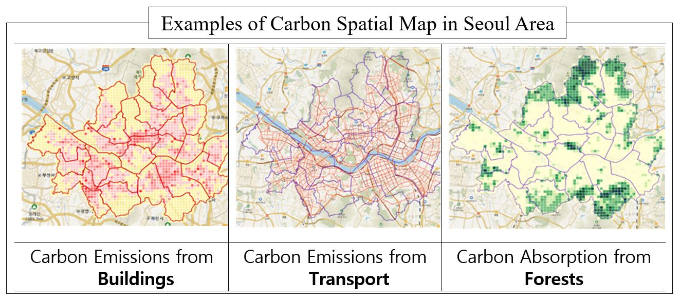
Carbon Spatial Map (https://www.carbonmap.kr) is a data-based map system that visualizes activities in carbon emissions from buildings
and transportation sectors, and in carbon absorptions from forests shown by administrative district or grid unit created in order to support
legal actions on the Framework Act on Carbon Neutrality.
Based on the energy usage of approximately 7.2 million buildings nationwide, traffic volumes by road segment, and map of forest type,
carbon emissions and absorption information have been precisely updated annually in 1km, 500m, and 100m grid units operated by the
Korea Land and Geospatial Informatix Corporation (LX) since June 2023.
Please refer to the attached files or the preview for more details!